Information
-
Site conducted
-
Hazardous tree inspection form
-
Document No.
-
Park
-
Site
-
Region
-
Inspection completed by
-
Position
-
Date of inspection
Inspection details
-
Add details of hazardous tree
-
Location of tree
-
Description of the trees location
-
Photograph of tree
-
Description of the tree/situation
-
Some identifiable structural flaws in trees include: dead wood of a size that will cause damage when it falls, trunks with seams or cracks, decay, root damage, cankers, leaning trees, structural damage, twisted trunks and unbalanced canopies.
-
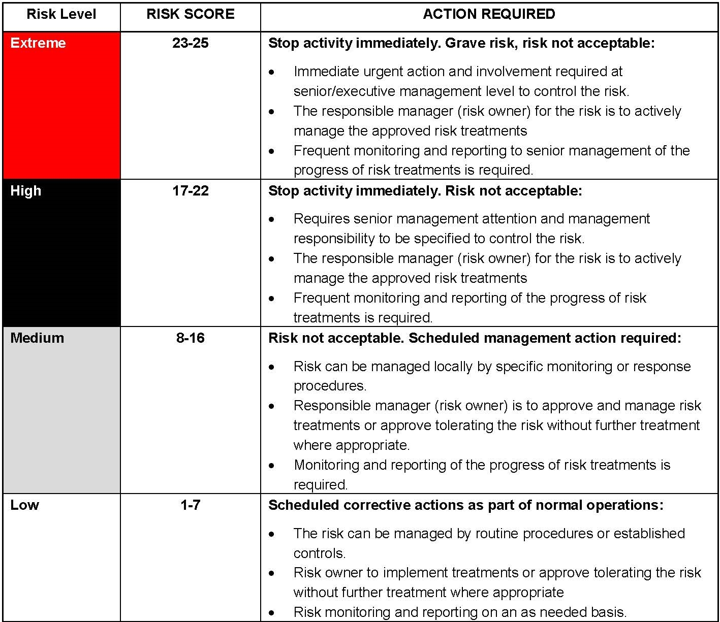
Risk rating (please swipe right to view risk calculator)
- Low (1)
- Low (2)
- Low (3)
- Low (4)
- Low (5)
- Low (6)
- Low (7)
- Medium (8)
- Medium (9)
- Medium (10)
- Medium (11)
- Medium (12)
- Medium (13)
- Medium (14)
- Medium (15)
- Medium (16)
- High (17)
- High (18)
- High (19)
- High (20)
- High (21)
- High (22)
- Extreme (23)
- Extreme (24)
- Extreme (25)
-
Controls required
-
Date completed
-
Signature
Risk calculators
Risk calculators: hazardous trees
-
Underlying principles
1. Common defects in trees are: dead wood, decay, root damage, cankers, leaning trunks which are progressively leaning further and structural damage such as splits and cracks. Any single defect or a combination of defects may or may not constitute a structural flaw. A commonsense judgement should be used or expert advice sought where necessary.
2. A tree with defects is not hazardous unless some portion of it is within striking distance of a target.
3. The likelihood of a hazardous tree injuring someone depends on the height of the tree (the potential fall zone) and the length of time spent under it.
4. Trees with defects such as dead limbs, hollows etc. are a natural part of the Australian bush. They have significant environmental value for native wildlife.
5. Felling a hazardous tree in a Protected Area should be avoided if it is possible to do so and remain within the principles of risk reduction. Investigate all other options of protecting life and property first.
6. Live, healthy trees may also be hazardous at times (e.g. fruiting Bunya Pines and coconut palms). -
Where permanent infrastructure is the potential target of a hazardous tree, likelihood will be determined based on observations rather than by using the following tables.
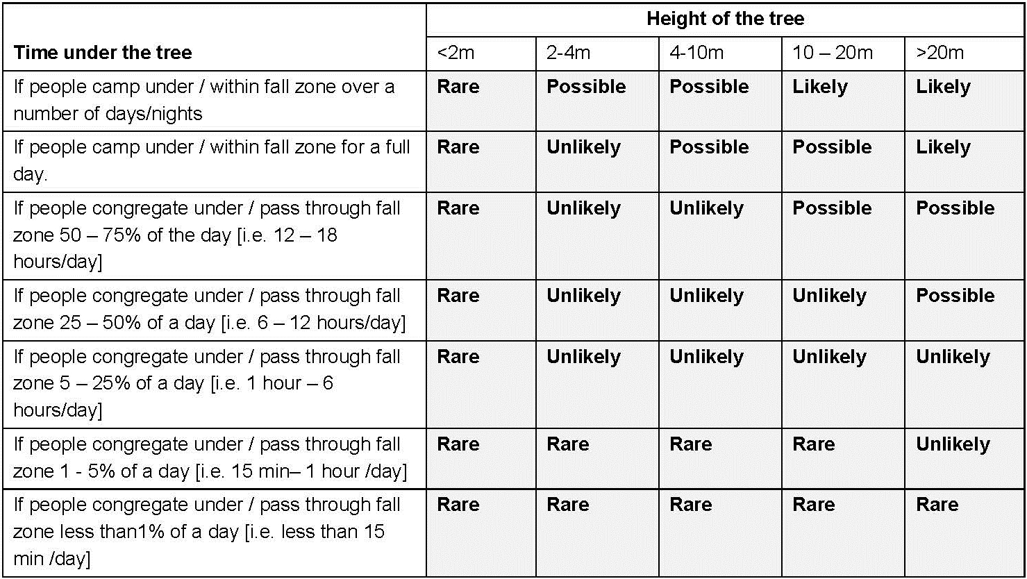
Step 1: Determine the likelihood of a hazardous tree injuring a person/s or damaging vehicles
-
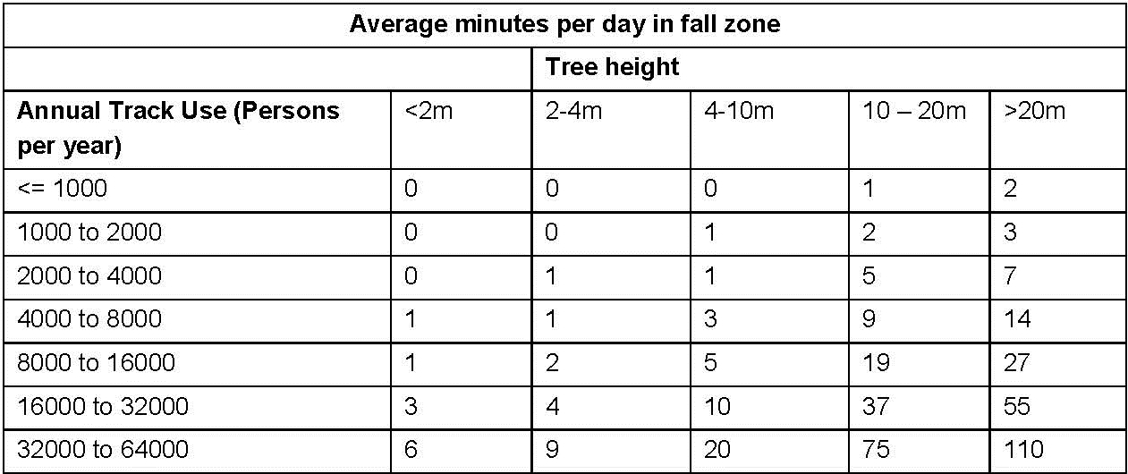
When calculating exposure times for walking tracks, use the following table to determine how many minutes per day people on the track are within the fall zone of a hazardous tree.
-
-
For campgrounds, day use areas, management facilities and other areas where people or vehicles congregate under hazardous trees, exposure times are to be based on observations and visitor statistics.
-
Step 2: Determine the level of risk to person/s or vehicles
-
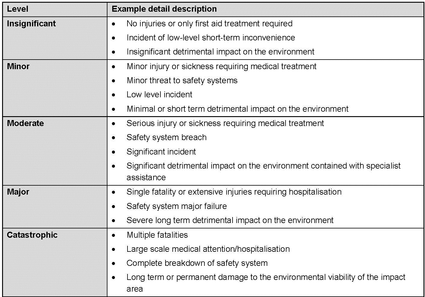
Qualitative measure of consequence or impact
-
-
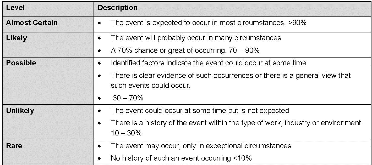
Qualitative measure of likelihood
-
-
Risk Rating matrix - level of risk
-
-
Risk Evaluation Table
-
Further information
-
When adding GPS coordinates for trees, please also include a detailed description of the trees location and or a photograph (i.e. 20m from trailhead XX; LHS of track heading in north direction).
-
Examples of control options
1. Close the area until the hazardous tree/s have been eliminated/reduce.
2. Trim any hazardous parts of a tree.
3. Remove facilities such as tables, BBQs from underneath hazardous trees.
4. Fence off the area around the hazardous tree/s.
5. Relocate the site to avoid the hazardous tree/s.
6. Fell the hazardous tree (last resort only). To be considered when the risk is High to Extreme unless other mitigating factors make removal essential.


